 |
|
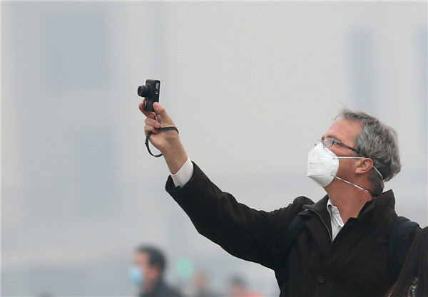
The smog-stricken Beijing will see mild rainfall on Wednesday afternoon, then gales at night, expected to disperse the week-long notorious smog, China's Central Meteorological Observatory forecast on Wednesday morning. A visitor wearing a mast takes a picture at the Tian'anmen Square on a dazy day on Feb 25, 2014. |
A cold front will bring wind, rain and snowfall to northern China starting Wednesday, along with a temperature drop, expected to disperse the week-long smog that has been choking the region, the central meteorological observatory forecast on Wednesday morning.
Beijing will see mild rainfall on Wednesday afternoon, then gales at night, long-anticipated smog dispersers, although severe smog will still cloak the city for most of the day, according to the forecast. The city issued another pollution alert, at the second-highest "orange" level, at 6:00 am on Wednesday.
North China's Tianjin, Shanxi and Hebei provinces, the mid-eastern part of Inner Mongolia, and Northeast China provinces will see light to moderate snow or sleet from Wednesday evening to Thursday morning, as the cold wave moves east, the forecast said.
Parts of East China's Shandong, Anhui and Jiangsu provinces north of Huaihe River will see a 4-6 Beaufort scale northerly winds, likely to defuse the smog and fog, along with a temperature drop of 6-10 degrees (Celsius).
PM2.5 concentrations in southern Beijing reached 500 micrograms per cubic meter, the worst since the choking smog reached the city on Feb 20 , Beijing Times reported on Wednesday, citing statistics from the Beijing Municipal Environmental Protection Monitoring Center.
|
 |
 |
| Chilly run gets blood pumping | Beijing upgrades haze alert from yellow to orange |


